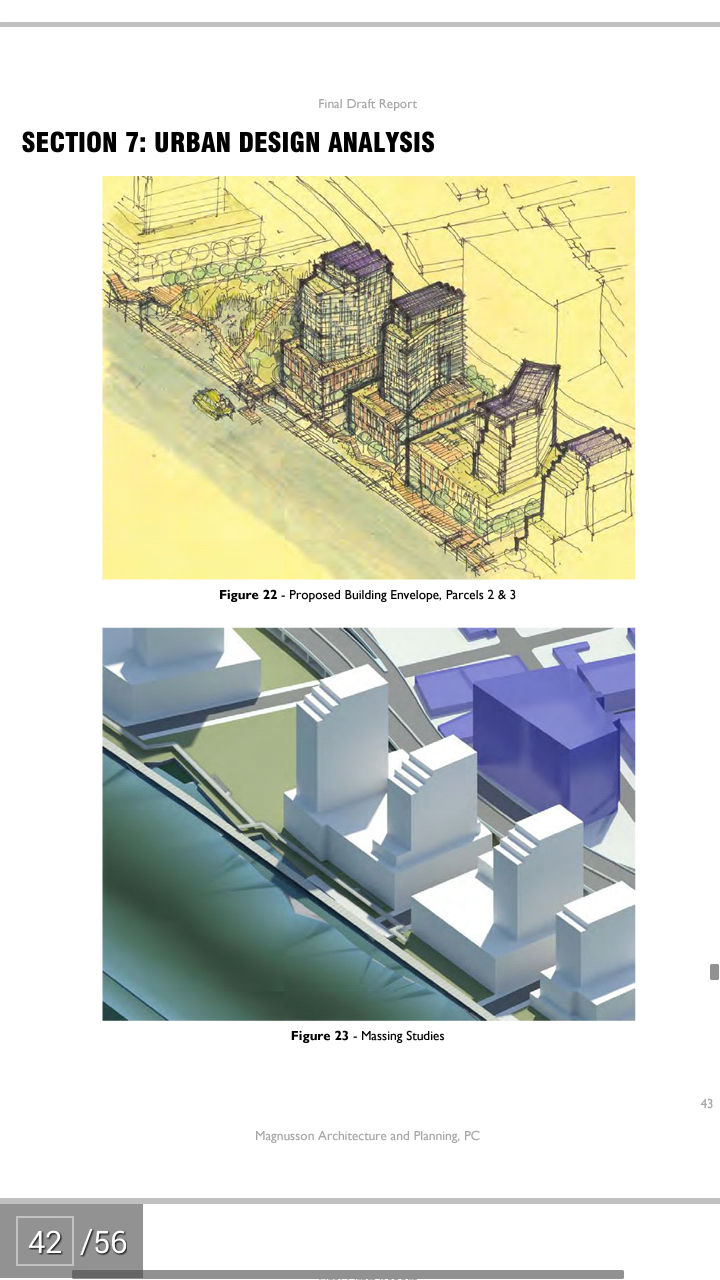
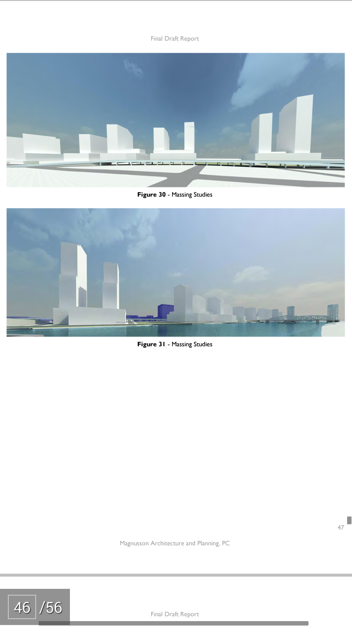
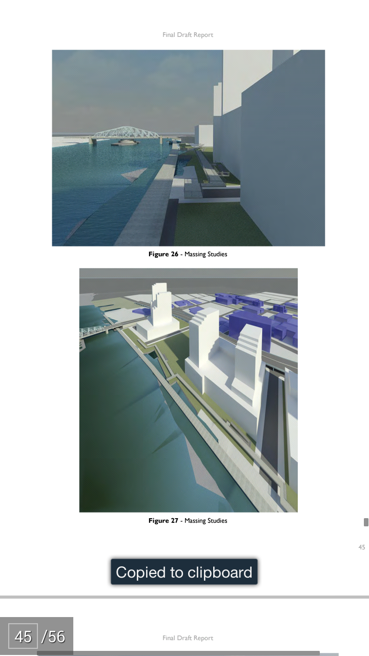
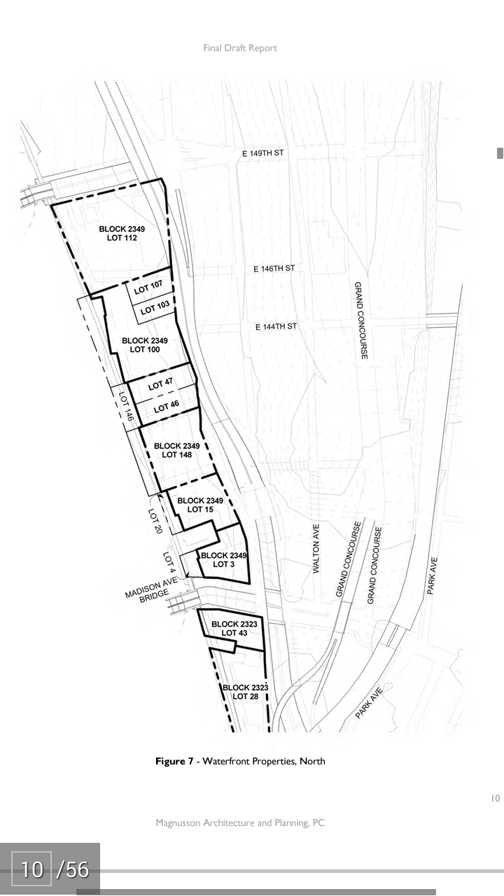
Last month during the State of the Borough address by Bronx Borough President Ruben Diaz Jr, he unveiled plans to create a waterfront district along the Harlem River in the Lower Concourse Rezoning District.
We have received a copy of the 55 page report by Magnusson Architecture & Planning, LP on behalf of the South Bronx Overall Economic Development Corporation (SoBRO) and have read the entire document and will provide a more detailed analysis than has been provided by the mainstream media.
One of the most important and striking components of the Special Harlem River Waterfront District Plan as developed by Magnusson is that it proposes a mixed use and mixed income approach providing for all types from affordable to market rate housing.
When the plan was revealed, many folks, including myself, were immediately on alert because there was no mention of mixed income affordable housing and the media pretty much played into the gentrification hype.
Currently, the 2009 rezoning of the Lower Concourse allows for over 3,000 residential units, more than 1.5 million square feet of commercial space, and over 3 million square feet of community facility space just in the Special Harlem River Waterfront District alone.
According to the report:
“Rather than using these maximum numbers above, our recommended approach is a zoned development area that will create a sustainable community that meets the needs of the future residents, visitors, and businesses; while impacting the surrounding neighborhoods in a positive manner. We have begun to adjust these maximum numbers by implying program (housing, supermarkets, entertainment, schools, cafes, pharmacies, dry cleaners, parking, etc.) across all the parcels located within the conceptual site plan.”
The Magnusson plan calls for 2,100 residential units, 1 million square feet in commercial space and just 350,000 feet of community facilities. This latter part should be increased and equal the commercial space due to the lack of community oriented spaces in the South Bronx and the borough as a whole.
The report goes on to discuss each parcel at length and is as follows:

Program Analysis
Parcel 1
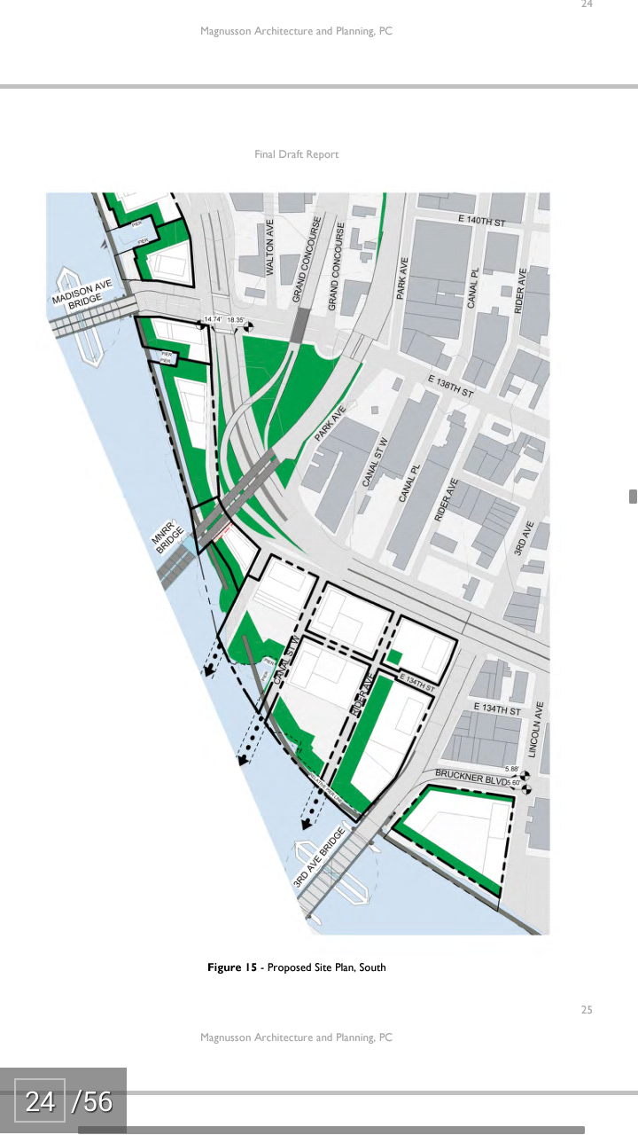
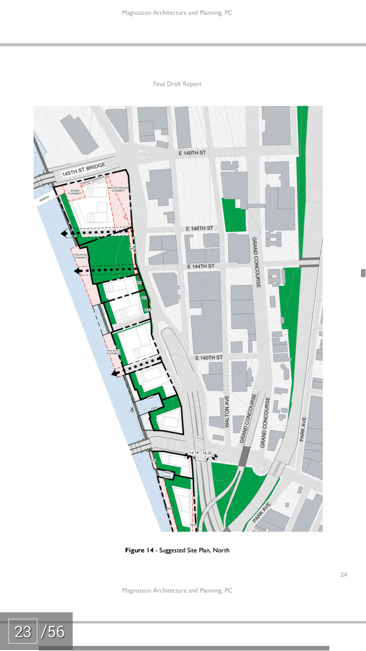
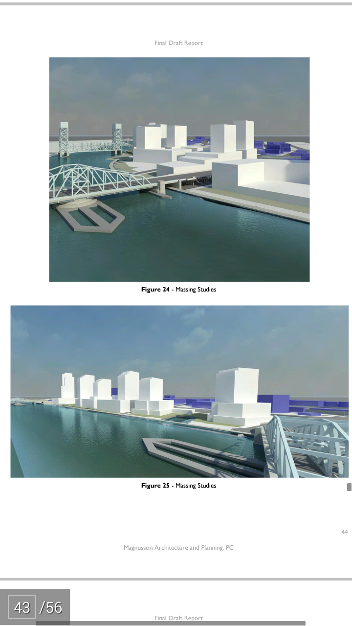
The base zoning for this site is commercial (C4-4) which has a residential equivalent of R7-2. The commercial uses would be focused around entertainment uses – movie theater complex, gallery, and potential indoor sports such as bowling or gymnasium, dining (indoor and outdoor) cafes and/or pubs possibly with live entertainment, food for consumption along the outdoor promenade. Uses might also include specialty shopping such as clothing, baby products, and toys. Residential towers will rise above the commercial base. The area on the eastern boundary of Parcel 1 is an easement for maintenance and expansion of the Expressway. This area can become a public plaza with vendor cart locations, planting and sitting areas.
Parcel 2 and Parcel 3
These two sites are grouped together, since the two property owners are looking at doing a joint development. The base zoning for Parcel 2 is commercial (C4-4) which has residential equivalent of R72. The base zoning for Parcel 4 is residential (R7-2) with a commercial overlay (C2-4). The commercial uses for Parcel 2 would be focused around the needs of the residential community such as supermarket and/or specialty food shops, pharmacy, laundry, dry cleaner, other convenience retail and possibly specialty shopping, cafes and restaurants that would permit take-out orders. Parcel 3 would house community facilities within its base, such as a preschool and elementary school, and medical offices. Residential towers would rise above the bases.
The proposed public park for this community, as per the SHRWDE, is located between Parcel 1 and 2. The commercial uses, particularly food services should be organized to work with the park.
Parcel 4, Parcel 5 and Parcel 6
The base zoning for these sites is residential (R7-2) with a commercial overlay (C2-4). The base of these buildings could house community facility uses such as day care, elder care, social service offices, and medical offices. General retail/small food shops could be located along the base, particularly fronting the shoreline walkway. Residential towers will rise above the base, possibly some supportive housing, and/or senior housing. The intersection of Exterior Street and East 138th Street and the Madison Avenue Bridge forms ‘boundary’ within the Special Harlem River Waterfront District, effectively subdividing the study area into a north and south zone. East 138th Street is an extremely dangerous intersection for pedestrians. It is an exit and an entrance to the Major Deegan (I-87) Expressway as well as providing access to Manhattan via the Madison Avenue Bridge and the Third Avenue Bridge. This intersection has high volumes of vehicular traffic, particularly during morning and evening rush hours, with multiple turning lanes and complex traffic signaling. It effectively forms an “invisible yet tangible” barrier separating the neighborhoods between the north side and the south side of the intersection.
Parcel 7, Parcel 8, and Parcel 9
These sites, zoned residential (R7-2) with a commercial overlay (C2-4) are separated by ‘natural’ barriers on their north and south sides. On the north, East 138th is the barrier. On the south side, the land, owned by MetroNorth, is an undeveloped area that is the most natural shoreline frontage of all the sites. This area should be stabilized and preserved as a wetland and public open space. This area is also where the rail line engages the land and railway signaling and traffic control devices will have to be installed to protect the public as well as the trains. As these sites are somewhat insulated from the area to the north and south, development should focus on residential development above commercial bases. Commercial activity should consist of general retail needs for the residential community. Community facility space could be devoted to educational purposes with a focus on the potential wetland/public open space on its southern boundary.
ASSEMBLAGE SITES
The assemblage sites are those located between the Metro North railroad bridge (the southern boundary of Parcel 9 SHRWD) and the Third Avenue Bridge. The current zoning for these is mixed use MX: M1-3/R8. The current land uses are compatible with the zoning and can remain and continue to grow. However, a major land use along the shoreline is for industrial storage and personal storage. This is not necessarily the most productive use of the land and is inconsistent with the new residential and mixed use district planned for the SHRWD. As the area below the Third Avenue Bridge has slowly been developing with old warehouse buildings being converted to residential, new stores and restaurants, artists and antiques dealers occupying former industrial spaces, we thought to reorganize the area to make it more accessible and to bring a greater mixed use density to the sites. Commercial activities should focus on a major retail supermarket that would also serve the community south of the Third Avenue Bridge. Community Facility uses could focus on the burgeoning artist’s community south of the Third Avenue and provide gallery space, retail outlets devoted to arts and antiques and artist live/work housing.
The Magnusson Report ends with the following important summary which residents should be aware of:
SUMMARY
The following issues, as delineated in this report, have surfaced during our study:
—What is the impact of the development area on existing energy, water management, communications, and solid waste infrastructure?
o Can the existing wastewater treatment plants handle the additional load? o Can the existing power plants handle the additional load?
o Can the existing water treatment plants handle the additional load
—What is the scope of environmental mitigation of contaminated soil?
—What is the long-term value of the existing rail line and its affect on waterfront access?
—Can a consistent and resilient shoreline protection strategy be developed that unites all the sites?
—The parcels within the Special Harlem River Waterfront District all front (Exterior Street) on the underside of the Major Deegan Expressway. This area will need to be ‘renovated’ with sound vibration/absorption material under the roadbed structure, new lighting and new Exterior Street roadway paving
—How should legal grade be established at or above ABFE that can be a benchmark for all development
— What are the cost implications and regulatory sign-offs that are necessary to move the utility point of service at or above the ABFE?
—What are the traffic impacts on the Major Deegan (I-87) Expressway and the redesign of the following intersections?
o East 138th Street and Madison Avenue Bridge, including on and off ramps to the highway and local access streets
o East 149th Street and the 145th Street Bridge
—What are the regulatory sign-offs that are necessary to create a public or private shuttle bus and/or reroute existing bus routes.
—What are the regulator sign-offs that are necessary to receive a parking requirement reduction?
—What is the cost impact for insurance on a project in a flood zone (during construction and post occupancy)?
—Individual site development without the support of a publicly approved plan versus a plan that has been taken through a public approval process allowing flexibility on individual site development
As the questions poised above indicate, the development of the Bronx shoreline of the Harlem River presents many challenges. As the City of New York continues to grow, as once affordable neighborhoods in Queens, Brooklyn and northern Manhattan continue to ‘gentrify’, opportunities for affordable housing, sustainable development, and mixed use development become increasingly difficult to achieve. The Harlem River shorefront, between 149th Street and the Third Avenue Bridge, is a significant opportunity to develop a new mixed-use community in a unique location and, as an aspect of development, strengthen shoreline protection, provide important public amenities and open space to this underserved portion of the Bronx, build on the strength of the existing commercial and institutional presence – the Gateway Mall, Hostos College, Lincoln Hospital – and provide a significant amount of housing of varied typology and diverse income affordability.
We would also recommend that a development phasing plan be explored. As the area breaks down into three zones – The Special Harlem River Waterfront District can be divided into 2 zones, north and south of the Madison Avenue Bridge with the third zone being the area we have noted as the ‘Assemblage Sites’ (a portion of this area was examined in an earlier report to SoBro as a planning study for 2401 Third Avenue). Each zone should be looked at as unique and, to a limited extent ‘stand-alone’, for their development of new residential, commercial and community facility uses; tied together by the are 3 significant places for public access and open space – the shorefront public walkway, the proposed public park between SHRWD Parcel 1 and 2 and the potential wetlands open space at the south end of SHRWD Parcel 9. Furthermore, each of the zones can be tied together visually though urban design standards for paving, lighting, and graphics.
Shoreline protection and resiliency along with infrastructure should be developed comprehensively and phased into place so that site development can proceed in as flexible manner as possible. Comprehensive planning that engages all stakeholders and sets urban design standards coupled with sustainability and resilience standards needs to be adopted to insure that these difficult sites have the framework for successful and financially strong development.
====
Together, as a community, we can unite and decide the date of our waterfront and address our needs as a borough and this plan offers just that as well as calls for community input.
It should be noted that it was Magnusson’s master plan that rebuilt the northwestern section of Melrose almost from the ground up adding over 3,000 units of housing.
Melrose Commons eventually became the ONLY LEED Certified Neighborhood district in the entire State of New York.
Magnusson already has a proven track record of planning sustainable development and communities and I welcome the opportunity to work with our fellow residents, politicians, and developers in creating a brighter future for our borough.


